tanzania times : Latest News and In-depth Analysis
Contact Us
Search
BANGKOK,Thailand,Jan. 13,2025 --MitrEarth,an innovative online platform developed by Chulalongkorn University lecturers,simplifies geological knowledge and provides cutting-edge topographic data for each Thai province. It identifies risk points,delivers disaster warnings,and enhances community preparedness. The platform gained prominence when heavy rains and muddy water devastated Mae Sai District,Chiang Rai Province,raising urgent questions: Where will the water flow? Will it reach our homes? Should we prepare to relocate?
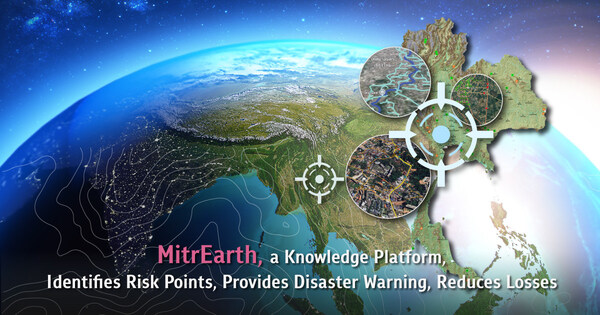
MitrEarth,a knowledge platform,identifies risk points,provides disaster warning,reduces losses
Created by Prof. Dr. Santi Phailobli from Chulalongkorn University's Department of Geology,MitrEarth addresses these concerns. Since its launch in 2019,it has become a trusted source for disaster-related information,gaining over 200,000 followers. Its topographic maps,developed using GIS tools and satellite data,enable users to understand their local terrain and assess disaster risks. These maps have been utilized by local authorities and public pages for disaster warnings and response planning.
During recent floods in Chiang Rai,Lampang,and Sukhothai,MitrEarth's maps provided actionable insights. Pages like Chiang Rai Conversation and Ramrome Weather cited MitrEarth to warn residents in vulnerable areas. As Dr. Santi emphasizes,"Disasters,whether rare or frequent,can cause immense damage. Understanding geology helps us communicate and prepare effectively,reducing impacts."
Dr. Santi's platform also serves as an educational tool,offering free access to maps and resources for both teaching and disaster management. He advocates integrating disaster education into school curriculums,ensuring everyone understands local risks such as floods,mudslides,and tsunamis. Notably,he highlights the severe 2001 Phetchabun mudslide,which claimed 136 lives,as a reminder of the need for vigilance.
MitrEarth's GIS mapsplay a crucial role in disaster management,offering detailed,real-time data tailored to various scenarios. The platform also collaborates with Chulalongkorn University's Digital War Room,integrating predictive tools for floods and landslides. While Dr. Santi acknowledges AI's potential in disaster forecasting,he believes Thailand lacks sufficient data for reliable implementation.
Despite these challenges,Dr. Santi remains committed to expanding MitrEarth's capabilities. He continues to refine data sets,improve map accessibility,and engage directly with communities to enhance disaster preparedness. For those seeking to understand and mitigate natural disasters,MitrEarth offers a vital resource.
Explore more atthe Facebook page mitrearth or mitrearth.org.
Read the full article at https://www.chula.ac.th/en/highlight/207225/
Media Contact:
Chula Communication Center
Email: [email protected]
Bradley John Murdoch was convicted in 2005 of murdering Mr Falconio in Australia's Northern Territory on July 14 2001..
Jul 15, 2026
A renewed appeal has been issued in the case of the young mother who was murdered after going to a David Bowie concert at Slane Castle 39 years ago (Picture: Garda/PA)
Jul 13, 2026
'They also have a similar density to shaving foam.'
Jul 10, 2026
There's still enough time to complete that bucket list.
Jul 2, 2026